

SSSI in Hong Kong

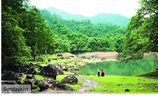
照鏡潭 / Chiu Keng Tam
烏蛟騰村落以南的木林,面積3.1公頃。
The site is a woodland to the south of the village of Wu Kau Tang. The area is about 3.1 hectares.

蠔涌谷 / Ho Chung Valley
蠔涌村上方的山谷,面積395公頃。
The site is the balley above the village of Ho Chung. The area is about 395 hectares.

薄扶林水塘集水區 / Pok Fu Lam Reservoir Catchment Area
薄扶林水塘集水區,面積217.3公頃。
The site is the direct catchment area of the Pok Fu Lam Reservoir. The area is about 217.3 hectares.

北大刀屻 / Pak Tai To Yan
北大刀屻山脊北面的峽谷,面積約32公頃。
The site consists of ravines on the north face of the ridge. The area is about 32 hectares.

鳳凰山 / Lantau Peak
鳳凰山的北面,面積約116公頃
The site is the north face of Lantau Peak. The area is about 116 hectares.

八仙嶺 / Pat Sin Range
八仙嶺北面森林密布的溝谷,面積約128公頃
The site is the forested ravines on the northern slopes of Pat Sin Range. The area is about 128 hectares.

��萬丈布 / Man Cheung Po
包括悟園及萬丈布一帶的山谷,面積約29.2公頃。
The site consists of the ravine below Man Cheung Po including the Ng Yuen Garden. The area is about 29.2 hectares.
鳳園谷 / Fung Yuen Valley
鳳園村後的森林深谷,面積約42.8公頃。
The site is the forested ravine behind the village of Fung Yuen. The area of the site is about 42.8 hectares.

白泥 / Pak Nai
白泥村附近的沙坑,面積約為15.5公頃。
The site is the sandpit in the neightbourhood of the village of Pak Nai. The area of the site is about 15.5 hectares.

青山 / Castle Peak
青山山頂和東西兩面的山溝,面積約為73.7公頃。
The site consists of the summit and the ravines on the east and west faces. The area os the site is about 73.7 hectares.

南丫島南部 / South Lamma Island
南丫島的南部,面積約345公頃。
The site is the southern part of Lamma Island. The area is about 345 hectares.

大帽山 / Tai Mo Shan
大帽山的較高斜坡, 面積約95公頃。
The site consists of the higher slopes of Tai Mo Shan. The area is about 95 hectares.

丫洲 / Centre Island
丫洲是香港的一個島嶼,位於大埔區,吐露港中央,面積約3.1公頃。
The whole Centre Island in Tolo Harbour and the area is about 3.1 hectares.

泥涌海岸 / Nai Chung Coast
泥涌海岸位於渡輪碼頭附近的海岸,覆蓋約0.87公里的區域, 面積約2.2公頃。
This site covers an area extending about 0.87 km along the coast near the ferry pier. The area is about 2.2 hectares.

赤門海峽(北部海岸) / Tolo Channel (Northern Coast)
該地區位於船灣郊野公園之內,這是赤門海峽的北部陸地,從白沙頭��洲一直延伸到黃竹角咀,面積約1287公頃。
This is the northen land mass of Tolo Channel, extending from Harbour Island to Bluff Head. The area is about 1287 hectares, The site is located within the desginated Plover Cover Country Park.

鹽田仔及馬屎洲 / Yim Tin Tsai & Ma Shi Chau
該地區覆蓋了鹽田仔的東端丶整個馬屎洲以及連島沙洲,面積約54.4公頃。
The site covers the eastern tip of Yim Tin Tsai, the whole island of Ma Shi Chau and the tombolo connecting them. The area is about 54.4 hectares.

尖鼻咀 / Tsim Bei Tsui
位於新界西北部尖鼻咀警署(格網座標為JV923897)下方的尖鼻咀海濱位置,面積約2.1公頃。
The site is a seafront location at Tsim Bei Tsui just below Tsim Bei Tsui Police Post (JV923897) in the north-western part of the New Territories of Hong Kong. The area is about 2.1 hectares.

汀角 / Ting Kok
位於大埔汀角村附近的沿海地區,面積若37.5公頃。
The site is the coastal area near the Ting Kok Village, Tai Po. The area is about 37.5 hectares.

深涌海岸 / Sham Chung Coast
深涌海岸位於深涌灣和扯𢃇排(平礁)之間的海岸帶,位於西貢半島北部赤門海峽南側,面積約26公頃。
This site is a belt of coast between Sham Chung Wan and Tung King Pai (Flat Reef) on the southern side of Tolo Channel in the north-eastern part of Sai Kung Peninusla. The area is about 26 hectares.

鴉洲 / A Chau
沙頭角海西南部的一個小島,面積約4.4公頃。
The site is an island situated on the south-west part of the Sha Tau Kok Hoi. The area is about 4.4 hectares.